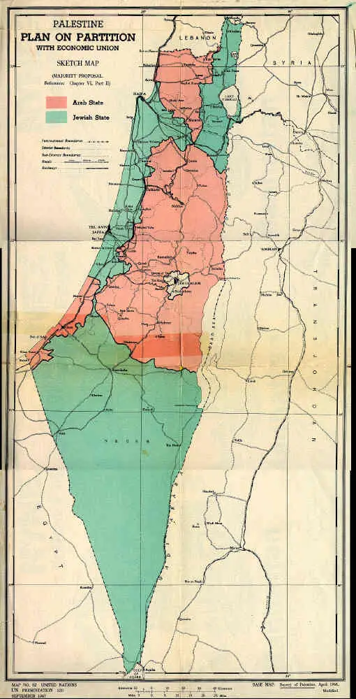
Maps of Palestine Partition Plans: U.N. Partition Plan
(September 1947)
Maps of Palestine Partition Plans: Partition Plans Maps: Table of Contents
The Jewish state is demarcated by the green shading. The pink indicates the area allotted to the planned Arab state. Jerusalem was to be internationalized and separated from both states.
 |
Sources: United Nations


