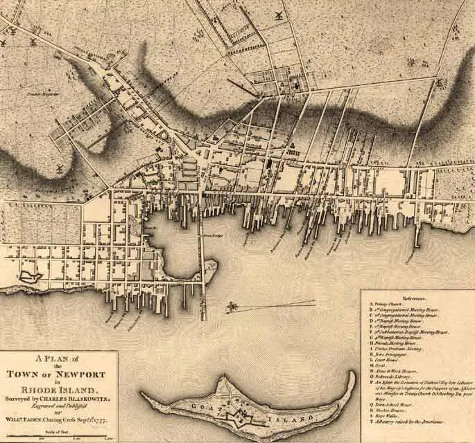
This early hand-colored map of Newport, Rhode Island was produced in London in 1777.
Referenced on the map are the houses of worship
of the various religious groups present in
Newport at the time, including Catholics,
Congregationalists, Baptists, Quakers, and
Jews.
Click
on map to enlarge
Charles
Blaskowitz
A Plan of
the Town of Newport.
London: William Faden, 1777
Hand-colored engraved map
Geography and
Map Division